Image collection »Gerlos«
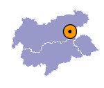
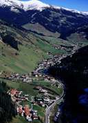
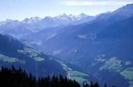
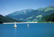
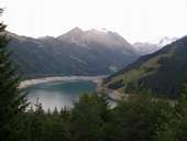
Gerlos - high above the Zillertal - encompasses most of the Gerlostal. The population centre is situated at the bottom of the valley on around 1200 m above sea level. Except of the hamlet of Gmünd, the seven hamlets have grown closely together. People there gain their living from tourism. South and north of the Gerlostal there are four other valleys with numerous alpine pasture lands. The reservoirs of Durlassboden and Gmünd, with their hydropower stations of Funsigau and Rohrberg, characterize the landscape in the valley. Gerlos, after Mayrhofen and Tux, has the third highest figure of over-night stays due to the ski lifts going up to the skiing areas of "Zillertal Arena" and "Fürstenalm".
|
|
|
|
|
|
