Image collection »Finkenberg«
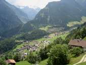
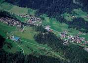
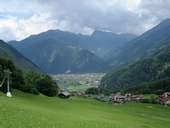
By area, Finkenberg is the second largest community in the Zillertal. Finkenberg consists of the centre, which is around the street running up to the Tuxertal, Dornau, the new settlement of Zellberg and several hamlets at the entrance of the Tuxertal. It furthermore stretches from Dornauberg, which has grown close to Ginzling with which it forms a settlement unit, over the western Zemmtal to the Zamsergrund with its highest summit - the Hochfeiler (3510 m). The individual villages are characterized by tourism related infrastructure (the station of the bottom of the ski lifts "Ski-Zillertal 3000"). The mountain slopes are dominated by alpine pasture lands (many farmers from South-Tyrol own land here) and hydropower stations (Rosshag with the Schlegeis Reservoir and Bösdornau).

|

|

|

|
|
|
