Image collection »Tierser Tal«
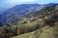
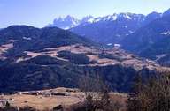
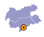
The Tierser Tal is a tributary valley of the lower Eisacktal and runs parallel to the valleys of Gröden and Eggental. The valley lies at the foot of the legendary Rosengarten. The left slope is forested. Archaeological records indicate that the area has already been settled during the Bronze Age, but the valley was only mentioned in a document in 999 for the first time. It can be stated that the Tierser Tal was one of the earliest high valleys in South Tyrol to be settled. On the slopes of the valley porphyry is visible, which contributes along with Schlern dolomite and Grödner sandstone to the geology of the valley. The Fassatal can be reached from the Tierser Tal over the Niger-Sattel and Karerpass.

|

|
|
Further links: Hazards Chronicle Tyrol, Weblink »Wikipedia«
